
23 Sep 3 New Maps Aim to Provide Additional Information to OWASA Customers
Three new maps published on OWASA’s website are aimed at supplying important updates to customers and providing answers to some frequently asked questions.
Outages & Alerts
Customers can get up-to-date information on any water outage or precautionary Boil Water Advisory that has been issued through one of the newly created maps. This map will be updated any time OWASA customers are experiencing a loss in service as part of our standard notification process.
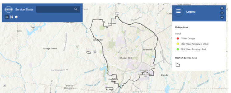
The outage area will initially show as a red circle on the map. As you zoom in, the shape of the outage will change and begin to show which customers are affected by the outage. As the outage is repaired and water service is restored, OWASA in many cases issues a precautionary Boil Water Advisory and the map will show a yellow shape to reflect that update. These advisories are typically in place for roughly 24 hours, until testing confirms the water remains safe to drink. Once those test results confirm that the water is safe, the map will update to a green shape and the Boil Water Advisory will be lifted.
Clicking on the shape along the way will provide details on the number of customers impacted, a timeline before the next update, and whether traffic is impacted.
If you are one of the customers impacted by a water outage or Boil Water Advisory, you will also receive a message directly from OWASA through OC Alerts. Make sure that your contact information and communication preferences are up to date so OWASA can communicate with you quickly as we have updates.
You can reach this new map feature of the OWASA website by clicking on the Outages & Alerts button on the home page.
Construction Projects
OWASA’s construction crew and contractors are active across the service area investing in the community’s water and sewer infrastructure by making improvements to piping and other equipment. Customers can stay up to date on projects by viewing another new feature on the website that shows where crews are working now and what projects are in the near future.
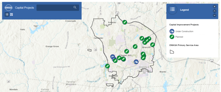
This map, on the Projects Near Me page of the OWASA website, is based on OWASA’s Capital Improvements Program. OWASA invests roughly half of every dollar received from rate payers back into the distribution and collection system, and this map will show where those investments are being made.
Icons on the map show whether a project is “Planned” or “Under Construction” and the approximate location of the work. Clicking on the icon will provide details about the project and contact information should you have any questions.
Service Area
The final map in the series of new features shows OWASA’s general service area. If you are moving to the area or moving to a new location, you can type in the address to see if the address is generally in the service area. The map does not guarantee that OWASA’s services are already available at that location, but it is meant to provide a quick answer about whether the service would usually be available.
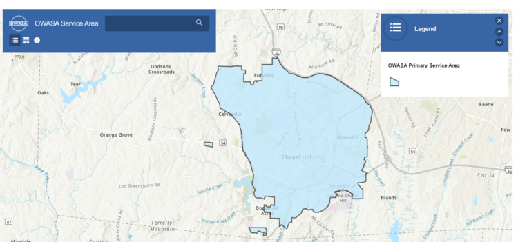
The service area map can be found on the Learn page of the OWASA website.